Everyone dreams of creating a garden of their dreams, where it would be convenient to relax, work, and just live. The question is, how do I do this? Of course, you can try to think everything out on the spot – some have a tremendous imagination and it is not difficult for them to imagine a particular building, overgrown or, on the contrary, just planted compositions of shrubs and perennials. Most people find it difficult to cover the entire territory in their imagination, and that is why a competent plot plan is required to create a single composition.
Designing even a small garden is not an easy task, but it is certainly interesting. As a result, you get a plan that will reflect all the ideas and functional tasks. Even a schematic drawing will allow you not only to think through possible changes and adjustments yourself, but also to talk “on the same level” with specialists from a landscape firm, if you decide to seek help and advice from a designer. Well, it will be easier for the designer if all your ideas are already laid out on a piece of paper, and do not appear from meeting to meeting.
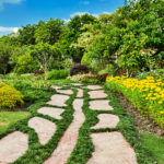
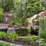
Looking for inspiration
It is not so important – you have a completely empty piece of land or with buildings and structures where there is a need for adjustments. When planning a plot, see as many photos, General plans of plots from the Internet and magazines as possible. A thorough review of ready-made solutions and their comprehensive assessment will not only avoid the most important mistakes, but also, perhaps, will prompt some interesting planning solutions.
")
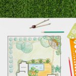
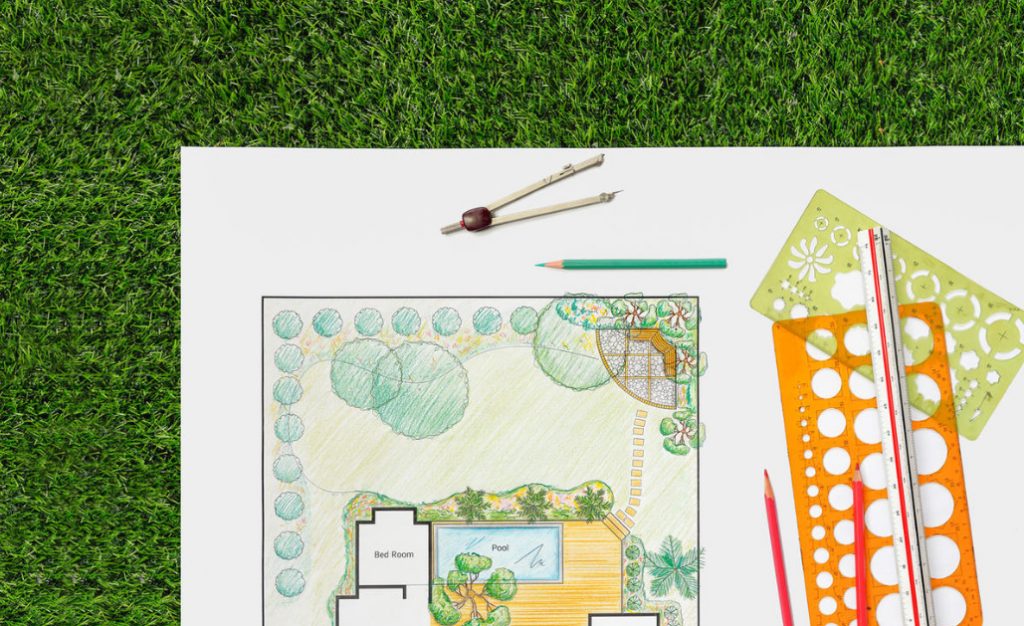
Garden design can be done on winter evenings or in the summer afternoon, sitting comfortably on the terrace, on a bench or in another favorite corner of the country nest. You will need: a sheet of paper (or better yet several), a ruler, an eraser, a simple pencil, and colored pencils. But first we need to know all the dimensions and distances (the length of the plot’s sides, diagonals, orientation to the cardinal directions, as well as the size of existing objects – houses, baths, fruit gardens, vegetable gardens, etc.).
")
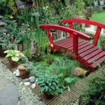
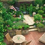
Write down all your ideas and ideas. You can and should rely on ready-made solutions from the magazine and the Internet, but not in the sense of repeating the main concept or the skeleton of the composition, but in terms of selecting some interesting elements. After all, we want to create our own garden, individual and unique, so we look at other works, conduct a comprehensive assessment of them, try to think differently and … connect all your imagination to make your dreams come true. Do not be afraid of mistakes or some unrealistic (at first glance) ideas-later everything will fall into place: this is the only way to reach a compromise and find out what is important and what is secondary.
Taking measurements
So, we have a blank sheet of paper on which we draw the existing boundaries of the site, oriented to the cardinal directions, a barn, garage, and adjacent objects – a road, a ravine, a forest (located directly outside the boundaries of the site), a neighbor’s house. At the same time, we note both picturesque objects and unsightly ones – this will help you later present beautiful views as effectively as possible and hide unwanted objects.
The drawing must be done at a scale, the most convenient in this work is considered to be a scale of 1:100 (1 cm on the plan corresponds to 100 cm (1 m) on the ground). On it, we also note existing and preserved buildings and landings, as well as terrain features.
")
If the plot is flat, we mark the highest and lowest points (based on personal observations or based on the results of geodetic survey of the site). If the differences are significant, it is likely that you will need to work on changing the terrain (geoplastics), building retaining walls (this is quite difficult work and requires certain skills, at this stage you can simply mark the desired location of the retaining wall, hill, waterfall, Alpine slide, etc.).
You can measure the site in various ways – the most accurate is topography (geodetic survey), but if the plan is for personal use and does not have to be official, you can make the necessary measurements yourself. In this case, you will need a regular tape measure, a dozen pegs and a coil of twine.
")
Fine, if you have a plan with the boundaries of the site, then all the structures, paths and plantings can be linked to the existing borders. If there is none, you will have to build the drawing of borders yourself. This is not very difficult work, but you need to approach it very responsibly, since the accuracy of measurements depends on the correct display of elements.
First of all, choose a corner of the plot, as close as possible to 90 degrees (straight), check it according to the rule of a right triangle, laying on the sides of the fence random size of each and calculating the hypotenuse (for example, the legs 3 m and 4 m, the hypotenuse by using the Pythagorean theorem must be equal to 5 m), and then comparing the obtained value with the measured on the ground.
After applying the angle to the plan, we can start measuring the sides of the plot. If the other angles are far from 90 degrees, measure the diagonals of the section. After we have drawn the boundaries of the site, we start drawing buildings and plantings using the binding method (to the fence or border). To do this, the corners of the Foundation of buildings, each landing place of tree and shrub vegetation are tied to the fence, measuring the distance perpendicular to the two adjacent sides of the fence. For convenience, we use pegs and twine, fixing the perpendicular direction (if the tape measure is short and its length is not enough to measure the entire distance).
")
When drawing up a situational plan that reflects the current position of objects and landings, you should also indicate (make a separate note about the corresponding values) the depth of groundwater, soil conditions, prevailing winds – these points will help us in the future to correctly locate the functional zones, select the assortment, and provide certain work to correct adverse conditions and site features.
Related posts:
 Pruning Shrubs
 Stone Economy, or How to Replace the Alpine Hill
 All Shades of Concrete, Or the Secrets of the “Grey Cardinal”
 Dry Masonry Walls
 Cover and … Decorate: Materials for Mulching
 The three Most Popular Mistakes that Gardeners Make
 Alpine Slide: Rules for Ordinary Gardeners
 The Chinese Garden: History, Philosophy and Types of Gardens
 Garden Paths With Their Hands
 Zoning of the Site With the Help of Partitions and Conventional Boundaries
 Gardening Suburban Area
 Arborsculpture in Furniture Design and Construction
 Creating a Multi-Level Garden: Landscape Design Techniques (Part 1)
Creating a Multi-Level Garden: Landscape Design Techniques (Part 2)
Creating a Multi-Level Garden: Landscape Design Techniques (Part 1)
Creating a Multi-Level Garden: Landscape Design Techniques (Part 2)
 Flowers In The Orchard: What You Can Plant And How To Care For (Part 2)
Flowers In The Orchard: What You Can Plant And How To Care For (Part 3)
Flowers In The Orchard: What You Can Plant And How To Care For (Part 2)
Flowers In The Orchard: What You Can Plant And How To Care For (Part 3)